Topography/Climate
The Ogasawara Islands is the general name for more than 30 islands scattered throughout a wide area of the Pacific Ocean within the coordinates from latitude 20 degrees 25 minutes North to 27 degrees 44 minutes North and from longitude 136 degrees 04 minutes East to 153 degrees 59 minutes East. In order from the north, it is formed by the Mukojima Islands, the Chichijima Islands, the Hahajima Islands, the Kazan (Iwo) Islands, and the three isolated islands of Nishinoshima, Minamitorishima, and Okinotorishima.
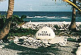
Okinotorishima is the southernmost and Minamitorishima is the easternmost location of Japan.
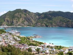
The main island is Chichijima, located approximately 1,000 km south from Tokyo. Its area is roughly 24 km2, which is more than twice the size of Chiyoda ward. The tallest mountain on Chichijima is Chuozan (Mt. Chuo) (318m). The circumference of the island is 58 km and has several coastlines.
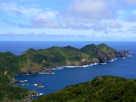
The location of Hahajima is approximately 50 km south of Chichijima, and its area is about 21 km2. There is Chibusayama (Mt. Chibusa) (463m) in the heart of the island. The circumference is 58 km and is mostly surrounded by steep cliffs.
Ogasawara is located in the subtropics with a comfortable marine climate where there is relatively little variance with the temperature. The annual average temperature in Chichijima was 23.3℃ in 2008. The maximum temperature was 33.6℃ and the minimum temperature was 10.9℃. There is no snow or fog throughout the year. Annual rainfall is about 1,600 mm, which is almost the same as Tokyo. The area surrounding the Ogasawara Islands is also a place where typhoons develop, and so the islands are sometimes affected by typhoons during the peak season.
Natural Environment
Plants and Animals
Natural Monuments
Okinotorishima Image Library (Movie)
(http://www.sangyo-rodo.metro.tokyo.jp/norin/suisan/okinotorishima/okitoridoga/okitoridoga-index.htm![]() )
)
Okinotorishima is the southernmost island of Japan (a coral reef) on the Pacific Ocean that extends from the Ogasawara Islands.
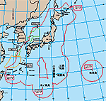
The importance of the Ogasawara village that includes Okinotorishima/ Minamitorishima increased, as the Japanese fishing zone became 200 nautical miles in 1977.